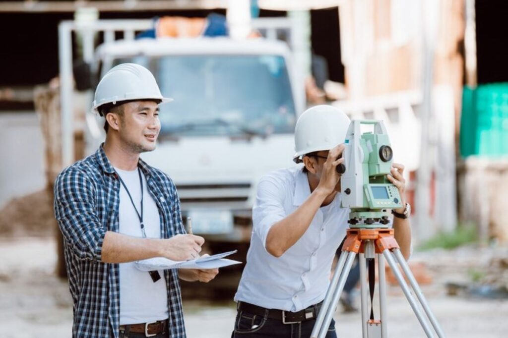
A cadastral surveyor plays a pivotal role in managing boundaries and aiding property transactions, ensuring that land is properly defined and recorded. Engaging a professional cadastral surveyor is essential for both buyers and sellers to navigate the complexities of property law and land registration. This article explores what you can expect from these specialists, the processes they follow, and how to choose the right one for your needs.
Understanding the role of a cadastral surveyor
A cadastral surveyor is responsible for mapping and defining land boundaries for legal purposes. This includes determining the exact dimensions of a property and making sure that these dimensions are accurately represented in legal documents. They are experts in land surveying and law, providing critical information that helps prevent disputes over property lines.
The importance of cadastral surveying in property transactions
Cadastral surveying is crucial in property transactions as it ensures clarity and legality. When purchasing land, buyers need to know precisely what they are buying. A cadastral survey provides this certainty, defining property lines and boundaries with exact measurements. It can also uncover any encroachments or disputes that might affect the property, thus protecting the buyer’s investment.
Furthermore, cadastral surveys are often required by law in many jurisdictions before property can be sold or transferred. This legal underpinning highlights the necessity of their work and the immense responsibility that comes with it. In addition to safeguarding buyers, these surveys also play a vital role in local government planning and development. Accurate cadastral data helps authorities make informed decisions regarding zoning, infrastructure development, and environmental protection, ensuring that land use aligns with community needs and regulations.
Key responsibilities of a cadastral surveyor
The primary responsibilities of a cadastral surveyor include conducting surveys to establish property boundaries, preparing accurate reports, and creating detailed maps. They must be proficient in using various tools and technologies to gather data effectively. Additionally, they engage in legal research to understand relevant laws and regulations that affect land ownership and use.
Furthermore, cadastral surveyors may also provide expert testimony in legal disputes regarding land and property, making their role even more crucial in ensuring fair outcomes. Their expertise can be instrumental in resolving conflicts, as they can clarify complex technical details for judges and juries. Moreover, cadastral surveyors often collaborate with other professionals, such as urban planners, engineers, and architects, to ensure that land development projects comply with legal standards and are executed efficiently. This multidisciplinary approach not only enhances the accuracy of land assessments but also fosters a more cohesive understanding of land use within the broader context of community development.
The process of cadastral surveying
The process of cadastral surveying involves several detailed steps that ensure accuracy and legality. It is a systematic approach requiring both field work and analytical skills to achieve reliable results.
Initial research and planning
The first step in the cadastral surveying process is initial research and planning. Surveyors collect existing data about the land, including title deeds, previous survey records, and local zoning laws. This research forms the foundation of their work, as it enables them to understand the legal descriptions of the property and any historical context that may affect current boundaries.
Following the research phase, surveyors develop a plan for the actual survey, deciding on the methodology that best suits the terrain and legal requirements. An efficient plan reduces the risk of errors and saves time during the fieldwork stage. Additionally, surveyors often engage with local authorities to ensure compliance with any regulatory frameworks that may govern land use, which can vary significantly from one locality to another. This proactive approach not only facilitates smoother operations but also fosters a cooperative relationship with stakeholders involved in land management.
Field work and data collection
The fieldwork phase is where the surveyor physically explores the property to collect data. They make use of advanced technologies, such as Global Positioning Systems (GPS) and total stations, to gather precise measurements. The accuracy of this phase is critical, as it lays the groundwork for producing reliable maps and legal descriptions.
In addition to technical measurements, surveyors also identify and mark physical boundaries on the ground. This process often involves collaborating with landowners to clarify existing features and historical markers that may influence property lines. This interaction can be particularly enlightening, as landowners often possess valuable insights about the land’s history and any informal agreements that may not be documented. Such discussions can reveal nuances that might otherwise be overlooked, ensuring a more comprehensive understanding of the property in question.
Analysis and map creation
After data collection, the surveyor analyses the gathered information. This includes assessing the measurements for consistency and accuracy to create a comprehensive property description. The analysis phase is vital for identifying potential issues, such as discrepancies in boundary claims or physical obstructions.
Once analysis is complete, the surveyor produces detailed maps that illustrate the land’s boundaries, notable features, and ownership details. These maps are not only visually informative but also serve as legal documents that can be used in property transactions or disputes. Furthermore, modern surveying techniques often incorporate Geographic Information Systems (GIS), which allow for the integration of various data layers, such as environmental features and infrastructure. This technological advancement enhances the utility of the maps, making them indispensable tools for urban planning, environmental assessments, and even community development initiatives, thereby broadening the impact of cadastral surveying beyond mere property delineation.

Skills and qualifications of a professional cadastral surveyor
A professional cadastral surveyor must possess a unique blend of skills and qualifications to effectively perform their duties. Their expertise is not only derived from theoretical knowledge but also practical experience in the field.
Educational requirements for cadastral surveyors
Most cadastral surveyors hold a degree in surveying, geography, or a related field. In addition to formal education, many countries require surveyors to be licensed or registered with a professional body. This often involves passing comprehensive examinations to demonstrate their proficiency and understanding of relevant laws and technical skills.
Continuing education is also important, as surveyors must stay updated on advancements in technology, legislation, and best practices in the industry. This commitment helps maintain high standards in the profession. Many surveyors engage in workshops, seminars, and online courses to enhance their knowledge and skills, ensuring they are well-versed in the latest methodologies and tools available in the rapidly evolving landscape of surveying.
Essential skills for success in cadastral surveying
Cadastral surveyors should have strong analytical skills to interpret complex data and legal documents. Attention to detail is paramount, as even minor inaccuracies can lead to significant legal disputes or financial loss.
Technical proficiency is also essential; surveyors must be familiar with various surveying instruments and software for mapping. Additionally, good communication skills are necessary to explain complex survey findings to clients and to work collaboratively with other professionals, such as lawyers and government officials. Furthermore, a solid understanding of land law and property rights is crucial, as cadastral surveyors often find themselves navigating intricate legal frameworks that govern land ownership and usage. This knowledge not only aids in the accurate representation of boundaries but also ensures that surveyors can effectively advocate for their clients’ interests in various legal contexts.
How to choose the right cadastral surveyor
Selecting the right cadastral surveyor is crucial for ensuring that your property boundaries are accurately defined and legally recognised. Here are some considerations to keep in mind during your search.
Factors to consider when hiring a cadastral surveyor
When choosing a cadastral surveyor, consider their qualifications and experience. It is important to verify that they are licensed and have a solid track record in completing similar projects. You might also want to review their portfolio or case studies to gauge their competency and style of work.
Another important factor is their understanding of local laws and regulations, as these can significantly affect the surveying process. A local surveyor will likely have better insights into these nuances than someone based farther away. Furthermore, they may have established relationships with local authorities, which can facilitate smoother communication and expedite the approval processes necessary for your project.
Questions to ask a potential cadastral surveyor
When interviewing potential surveyors, ask about their approach to the surveying process. Understanding their methodology can provide clarity on how they handle issues and ensure accuracy. Inquire about the technology they use, as advancements can impact the efficiency and reliability of the survey.
Additionally, discuss timelines and costs upfront to avoid surprises later on. A transparency regarding fees and project duration can foster a better working relationship and set realistic expectations. It is also wise to ask about their post-survey services, such as assistance with boundary disputes or the preparation of necessary documentation for land registration. This can be particularly beneficial should any complications arise after the survey is completed, ensuring you have continued support from a professional who understands your specific situation.

The impact of technology on cadastral surveying
As in many fields, technology is rapidly transforming the world of cadastral surveying. These innovations offer heightened accuracy and efficiency, reshaping the way surveyors perform their duties.
Modern tools used in cadastral surveying
Today, cadastral surveyors commonly use sophisticated tools such as laser scanning, drones, and Geographic Information Systems (GIS) to aid their work. These technologies allow for precise measurements and comprehensive data gathering that were not possible with traditional methods. Drones, for instance, offer an aerial perspective that can simplify the surveying of large or hard-to-access areas.
Furthermore, software applications enable surveyors to process and analyse data more efficiently. They can create detailed maps and models that help stakeholders visualise boundaries, leading to better-informed decisions regarding land use and ownership.
The future of cadastral surveying: trends and predictions
The future of cadastral surveying is poised for significant changes as technology continues to evolve. It is anticipated that automation and artificial intelligence will further enhance data accuracy and reduce human error. This means that surveyors may spend less time on fieldwork and more on data analysis and client interaction.
Sustainability is also becoming a key focus in surveying practices, with an increased emphasis on environmentally friendly methodologies that report on land usage as it relates to ecological impact. As surveying plays a critical role in urban planning and development, adapting to these trends will be crucial for the profession’s growth and relevance.
In conclusion, a professional cadastral surveyor is integral to ensuring clear and legal property boundaries. By understanding their role, processes, and the impact of technology, as well as how to choose the right surveyor, you can better navigate the complexities of property transactions and land ownership.
Related : The Importance of a Boundary Survey in Property Development
