
Boundary surveys play a crucial role in the world of property development, providing essential information that aids in the resolution of property disputes, guides planning procedures, and ensures compliance with legal standards. This article will explore the key aspects that underscore the importance of boundary surveys in this sector.
Understanding the Concept of Boundary Surveys
At its core, a boundary survey is a detailed examination of a parcel of land to determine the exact location of its boundaries. This process involves mapping the perimeter of a property, identifying property lines, and assessing any encroachments or discrepancies with neighbouring properties. Boundary surveys are not only necessary for new constructions but also vital during property transfers, ensuring that all parties are aware of the exact limits of their land.
The Role of a Boundary Surveyor
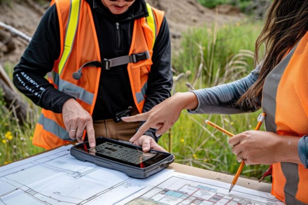
Boundary surveyors are the professionals responsible for conducting these surveys. They employ a combination of advanced technologies, such as GPS and total stations, along with traditional surveying methods to establish boundary lines accurately. Apart from measuring distances and angles, boundary surveyors must also be knowledgeable about local zoning laws and property regulations, ensuring that the survey complies with legal requirements.
This expertise allows them to prepare comprehensive survey documents that serve as a reference for property owners, developers, and legal entities during land disputes or development projects. Their role extends beyond inspection; boundary surveyors also liaise with local authorities and stakeholders, providing crucial data that informs planning and development decisions. Furthermore, their work can significantly influence property values, as clear and accurate boundary delineation can enhance a property’s marketability and appeal.
Key Elements of a Boundary Survey
A well-conducted boundary survey involves several critical elements. Firstly, it includes the identification of existing markers such as fences, walls, and trees, which may indicate property lines. Secondly, a comprehensive review of historical records and previous surveys is essential to ascertain all relevant information regarding the property boundaries. This helps to avoid conflicts and ensures accuracy.
Lastly, the survey culminates in the preparation of a survey plat, which is a detailed map showcasing the findings of the survey. This document not only records the boundary lines but also includes important features like easements, right-of-ways, and any potential encroachments, offering a helpful visual reference for property owners and legal representatives alike. Additionally, boundary surveys can reveal important information about the topography of the land, such as slopes and drainage patterns, which can be crucial for future development or landscaping projects. Understanding these elements can help property owners make informed decisions about how to utilise their land effectively, ensuring compliance with local regulations while maximising its potential value.
The Legal Implications of Boundary Surveys
Boundary surveys are not just technical exercises; they also carry significant legal weight. Understanding the legal implications is essential, especially in cases of boundary disputes or property development projects that adjoin existing properties.
Boundary Disputes and Resolutions
One of the primary legal implications of boundary surveys is their ability to resolve disputes. Differences in perception regarding boundary lines can lead to conflicts between property owners. A boundary survey can clarify these issues, providing an objective determination of property lines based on established evidence and laws.
When disputes arise, the results of a boundary survey can be presented in legal proceedings. Courts often rely on the findings of licensed surveyors to adjudicate boundary-related disputes, making it imperative that the survey is conducted according to the highest standards of accuracy and professionalism.
Moreover, boundary disputes can escalate quickly, leading to costly litigation and strained relationships between neighbours. In many cases, a boundary survey can serve as a first step towards amicable resolution, allowing parties to engage in constructive dialogue based on factual data rather than assumptions. This proactive approach not only saves time and resources but also helps maintain community harmony, which is particularly valuable in tightly-knit neighbourhoods.
The Legal Standing of Boundary Surveys
The legal standing of boundary surveys is reinforced by the recognition they receive in various jurisdictions. Courts often uphold the surveyor’s findings, establishing the boundaries as delineated in the survey. This emphasizes the importance of hiring qualified surveyors with a solid reputation, as their professionalism directly impacts the enforceability of the survey results.
Additionally, boundary surveys contribute to the documentation of land ownership. They serve as evidence that can be used to prevent future disputes and clarify property rights, making them an indispensable aspect of property development initiatives. In the context of urban development, for instance, accurate boundary surveys are crucial for ensuring compliance with zoning laws and regulations. These surveys not only delineate property lines but also help developers understand the limitations and opportunities of their land, thus guiding the design and implementation of their projects in a legally compliant manner.
Furthermore, the implications of boundary surveys extend into the realm of property financing. Lenders often require boundary surveys as part of the due diligence process before approving loans for property purchases or developments. This requirement underscores the survey’s role in assessing risk and ensuring that the property in question is free from encumbrances or disputes that could affect its value. As such, boundary surveys are not merely a formality; they are a critical component of the real estate transaction process that can significantly influence investment decisions.

The Impact of Boundary Surveys on Property Development
The influence of boundary surveys extends beyond legal matters; they are integral to the property development process itself. By providing accurate information about property boundaries, surveyors play a critical role in shaping development plans.
How Boundary Surveys Influence Planning
Before embarking on any development project, it is essential to have an accurate understanding of the property boundaries. Boundary surveys inform the planning stage, ensuring that developers are aware of limitations and obligations concerning the neighbouring properties. This information aids in designing projects that comply with zoning regulations and land use policies.
Moreover, accurate boundary surveys help prevent costly redesigns or adjustments during the construction phase. By identifying potential issues ahead of time, developers can mitigate risks and save valuable time and resources. The precision offered by modern surveying techniques, such as GPS and laser scanning, allows for a level of detail that was previously unattainable. This technological advancement not only enhances the accuracy of boundary delineation but also enables developers to visualise their projects in relation to existing structures and natural features, further informing their design choices.
The Role of Boundary Surveys in Risk Management
Risk management is another significant aspect of property development, where boundary surveys play a vital role. By conclusively establishing property lines, surveys help developers identify potential risks associated with land disputes that could arise post-construction.
Understanding neighbouring boundaries clarifies where developers can build or make modifications, thus safeguarding against encroachments that could lead to legal challenges. Additionally, by implementing survey results into their planning, developers can ensure compliance with local regulations, thereby reducing the chances of enforcement actions or fines in the future. Furthermore, boundary surveys can also aid in assessing environmental considerations, such as flood zones or protected areas, which are crucial for sustainable development. By integrating these surveys into their overall risk management strategy, developers not only protect their investments but also contribute to responsible land use, fostering a balance between development and environmental stewardship.
The Process of Conducting a Boundary Survey
The process of conducting a boundary survey is systematic and requires careful consideration. Understanding this process is crucial for property developers to ensure that surveys are executed effectively and yield accurate results.
Pre-Survey Considerations
Before the actual survey begins, several pre-survey considerations need to be addressed. It is essential to gather relevant documentation, such as previous surveys, property deeds, and local regulations. This initial phase allows surveyors to gain a comprehensive understanding of the property’s history and any existing disputes.
Additionally, it is crucial to assess site conditions. This involves examining the physical environment, noting any obstacles or features that could affect the surveying process. Proper planning ensures that the survey proceeds smoothly and efficiently, minimising unnecessary delays. Surveyors often conduct a preliminary site visit to familiarise themselves with the terrain, which can include anything from dense vegetation to existing structures that may obscure property lines. This proactive approach not only aids in logistical planning but also helps in identifying any potential challenges that may arise during the actual survey.
Steps Involved in a Boundary Survey
The boundary survey process includes several key steps to ensure accuracy. Initially, surveyors will establish control points on the property, which serve as reference markers for measurements. Next, they will carry out detailed measurements of the property lines, employing both traditional and modern surveying techniques.
Following the measurement phase, the surveyor will analyse the data and prepare a comprehensive survey plat, complete with notes on any found encroachments or irregularities. This document is not merely a technical drawing; it often includes annotations that provide context and clarity regarding the boundaries and any notable features of the land. Finally, the results will be communicated to the property owner, and the surveyor may consult with local authorities to resolve any potential issues arising from the findings. This collaboration is vital, especially in areas where zoning laws or land use regulations may impact future development plans. Engaging with local councils can also facilitate a smoother approval process for any subsequent construction or alterations, ensuring that the property developer is well-informed and compliant with all necessary legal frameworks.
See Also : What to Expect from a Professional Cadastral Surveyor
The Cost and Time Implications of Boundary Surveys
Understanding the cost and time implications of boundary surveys is essential for effective budgeting and scheduling in property development. Factors influencing these aspects can vary based on location and project complexity.
Estimating the Cost of a Boundary Survey
The cost of a boundary survey can fluctuate significantly based on several variables. Factors such as the size of the property, the complexity of the boundaries, and geographical location all play a role in determining the final price. Generally, larger and more complex properties require more extensive work and expertise, leading to higher costs.
It is advisable for property developers to obtain multiple quotes and discuss specific needs with surveyors. This ensures that they find a reliable professional who can offer the best value without compromising on quality.
Timeframe for Completing a Boundary Survey
In terms of timing, boundary surveys can also vary in duration. Simple surveys may be completed in a matter of days, while more complex projects might take several weeks. Factors influencing this timeframe include the availability of documentation, the intricacy of the site, and potential weather delays.
For developers, understanding the expected timeline is crucial, as it impacts the overall project schedule. Early communication with surveyors about these timelines can help set realistic expectations and facilitate smoother project planning.
In conclusion, the importance of boundary surveys in property development cannot be overstated. They serve as a cornerstone for legal clarity, influence planning and development processes, and ensure that projects adhere to land use regulations. As property developments continue to grow, understanding the role and significance of boundary surveys is essential for all stakeholders involved.